Golden Plains Shire · Wadawurrung Country
Scarsdale
A borough of five thousand diggers in 1862, a town of 855 people now, on the Glenelg Highway west of Ballarat. Its story from the record, and what is here today.
Fig. 1
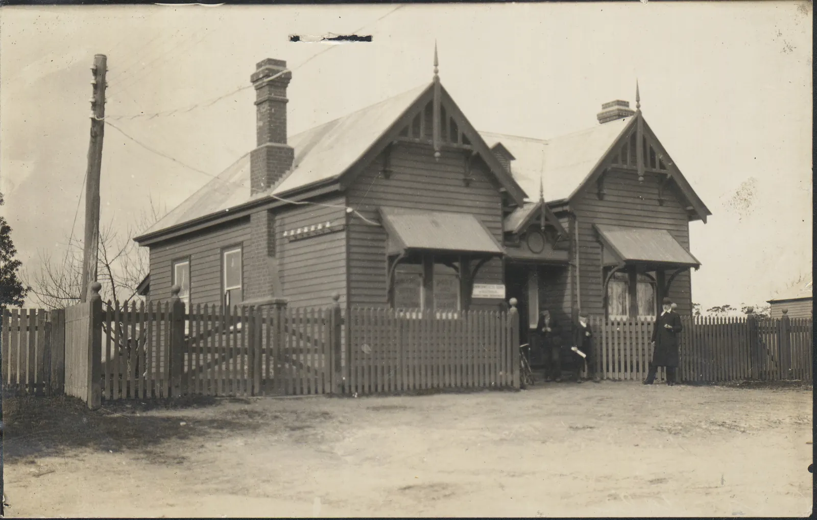
Browns, then Scarsdale
From the public record: the heritage listings, the mining surveyors’ reports, the newspapers, the State Library’s photographs. Where the sources disagree, the page says so. The year beside each part is the year it turns on.
Before 1837
Wadawurrung Country
Scarsdale is on Wadawurrung Country. In the Wadawurrung Traditional Owners Aboriginal Corporation’s own words: “We acknowledge that our Ancestors nurtured and cared for Wadawurrung Country for tens of thousands of years.”
The river beside the town is on the state register as Wurdi-yaluk, “big creek”, on the authority of the Victorian Aboriginal Corporation for Languages. The Corporation publishes nothing about Scarsdale itself that we could find; anything more is theirs to say.
1841
Moppiananum, and John Browne
The country the town stands on was the 30,000-acre run Moppiananum, licensed to Captain Charles Henry Ross in 1841. It passed to George Forbes, and then to John Browne, a Scot from near Dumfries: in 1848 by one account, early in 1850 by another.
After gold was found on his land, the diggers’ dogs got among his sheep, and Browne sold up and moved to the Anakies near Geelong. Browns is his name. Scarsdale’s has no documented origin: a 1907 gazetteer says it is after a place in Derbyshire, and the other stories are guesses.
From Joan Hunt, “The Scots at Springdallah”, Provenance 13 (2014), Victorian Places, Browns and Scarsdale, J. G. Saxton, Victoria Place-Names and Their Origin (1907) and Victorian Places, Scarsdale.
1854
Gold at Browns
Gold was found at Browns in 1854, 1855 or 1856: the three sources give three years. The shallow ground soon gave way to deep leads, worked by companies with steam engines. The North Briton Lead was found in November 1858 with two hundred shareholders on the list. In December 1861 one claim of the Main Lead Company washed 1,450 ounces from its dirt, and the Bute was paying “an excellent dividend of more than 200 ozs” a week. Scarsdale’s best years were 1861 to 1864.
Chinese miners worked the Smythes Creek goldfields, reworking the old diggings and the mullock, with a camp near Browns. The cemetery, laid out in 1861, has a Chinese section, which is rare in the shire.
On the plan: 7, Main Lead Co.; 8, Bute Co.; 9, Grand Reliance Co.; 10, Browns: the North Briton Lead; 11, Browns: the Golden Gate and the Contest Lead; 12, The cemetery.
Fig. 2
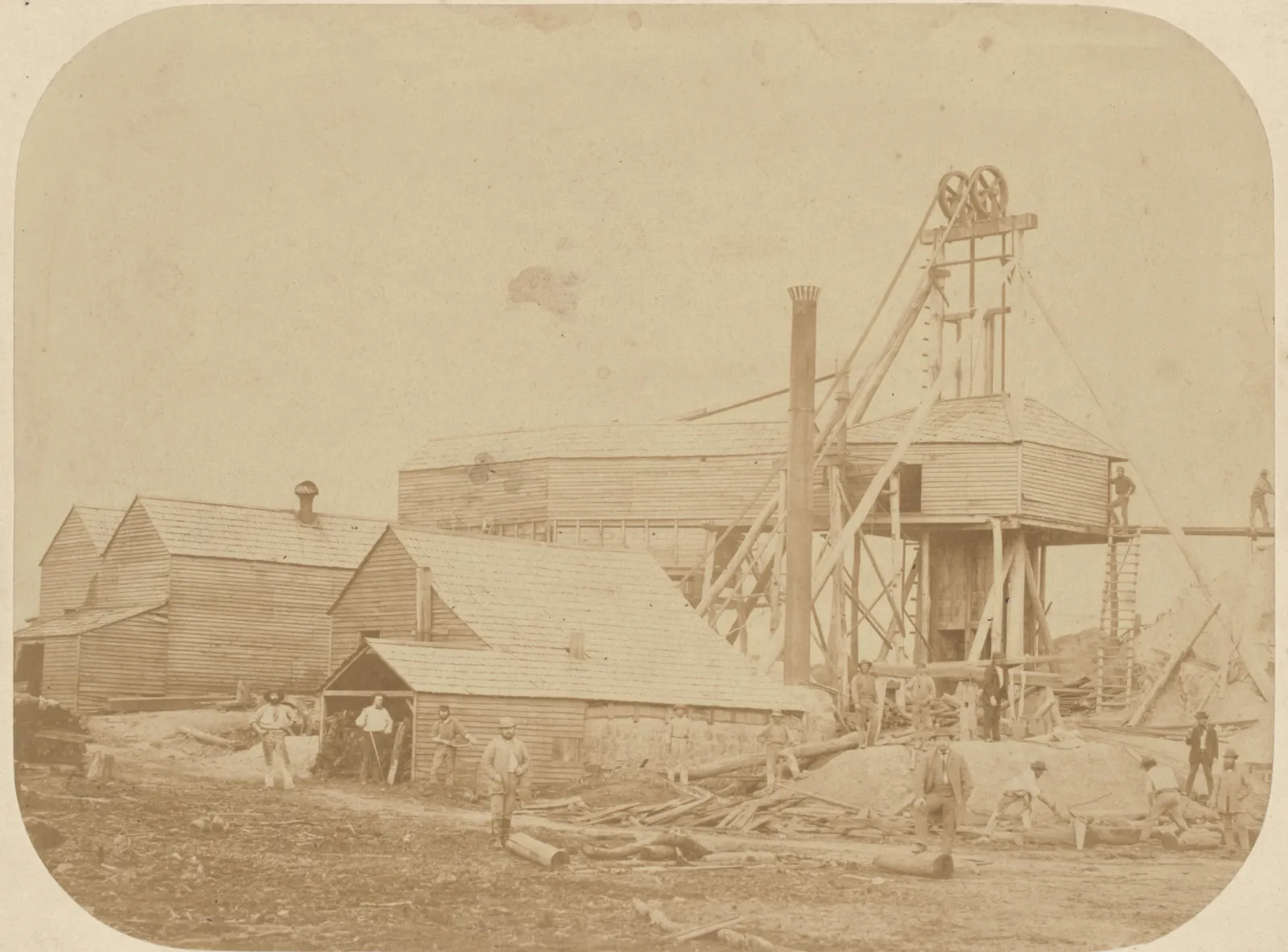
The United Browns Diggings Mining Company, 1861. Animated by AI from the photograph; the movement is ours, not the archive’s. State Library Victoria, H2037 From Joan Hunt, “The Scots at Springdallah”, Provenance 13 (2014), the Victorian Heritage Database, Scarsdale-Newtown precinct, Victorian Places, Scarsdale, the Heritage Inventory, North Briton Lead, the Heritage Inventory, Main Lead Co., the Heritage Inventory, Bute Co., the Woady Yaloak Historical Society’s sign at Smythesdale, as Aussie Towns transcribes it and the Victorian Heritage Database, Smythesdale Cemetery.
1862
A borough of its own
The Borough of Browns and Scarsdale was proclaimed on 25 July 1862. Its petitioners claimed more than five thousand people, fifteen hotels and fifteen hundred ounces of gold a week.
The town ran south along the Pitfield road until the next settlement down was called Newtown, with the public buildings at the crossroads. It had two foundries, two brickfields, a brewery, a tannery, its own newspaper, and Anglican, Presbyterian and Methodist churches.
On the plan: 1, The Scarsdale Hotel and the old post office; 2, The old town hall.
Fig. 3
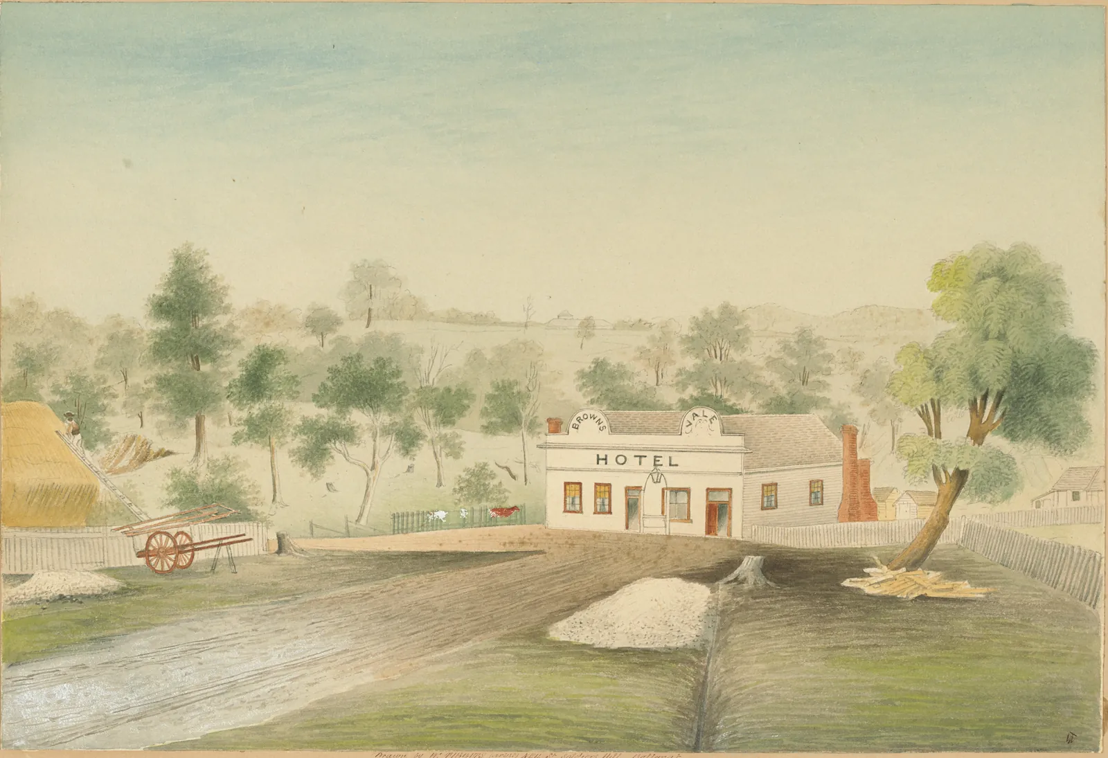
The Brownsvale Hotel, David Porter’s, drawn by William Tibbits about 1868: one of fifteen hotels in the borough. State Library Victoria, H35212 From Victorian Places, Scarsdale, Victorian Places, Browns and Scarsdale and the Victorian Heritage Database, Scarsdale-Newtown precinct.
1871
School No. 980, and the Mechanics’
The district’s first school was an Anglican one at Browns, in 1856. Common School No. 980 opened on 30 January 1871 to replace the private and church schools, with 542 children on its roll. The timber school was rebuilt in 1919–20, and one old schoolroom survives at the back.
The Mechanics’ Institute, built about 1868, fell into disuse and was nearly pulled down for a tennis court. It was bought in 1971 for $200, with the clock $20 extra, and taken to Sovereign Hill in 1972, where it stands on Main Street with Scarsdale’s bookcases still inside.
On the plan: 6, School No. 980 and the memorial gates.
Fig. 4
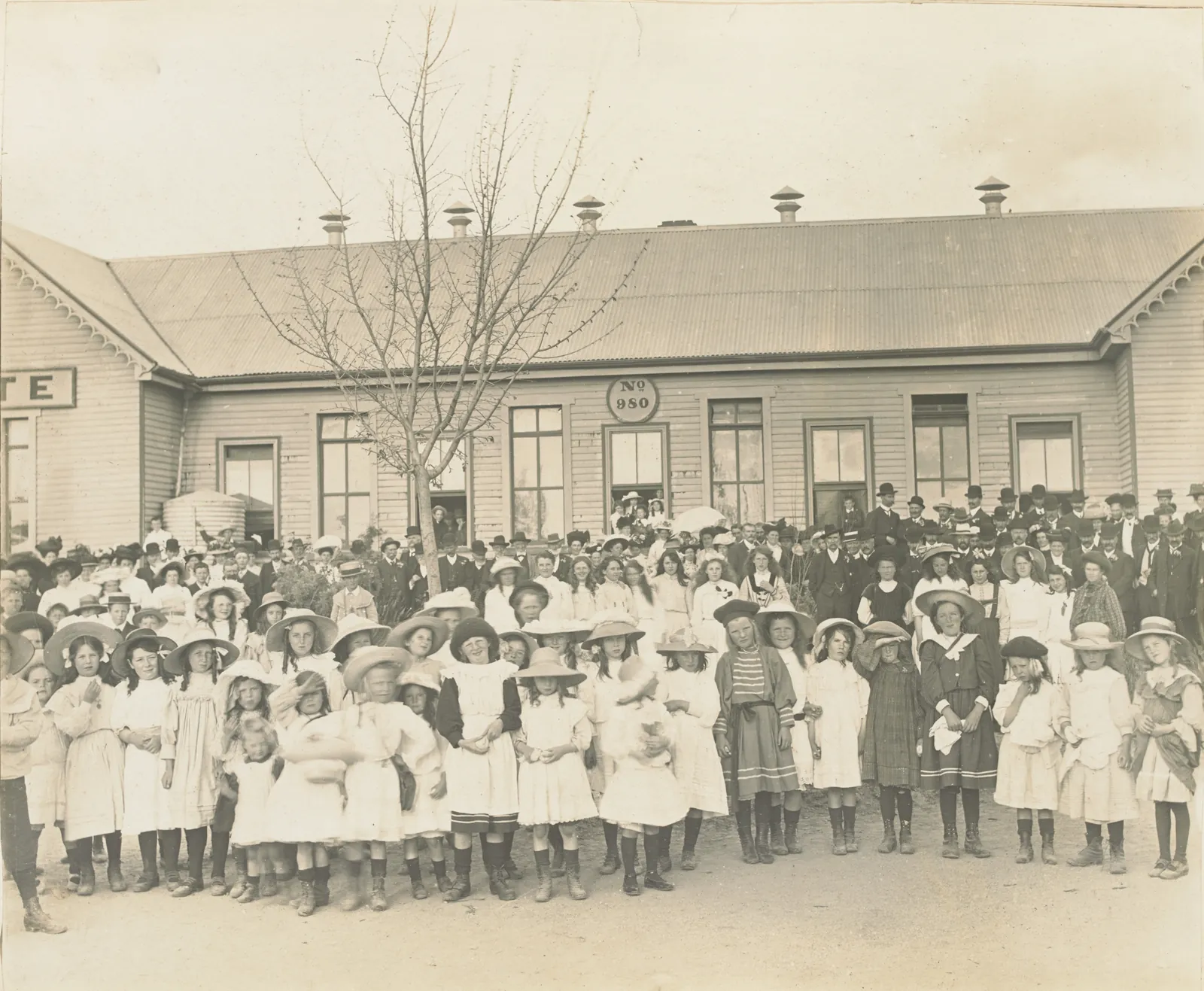
State School No. 980 on the Old Boys’ reunion day, 15 October 1909. J. G. Roberts’s album, State Library Victoria, MS 15304 From Victorian Places, Scarsdale, the Victorian Heritage Database, Scarsdale Primary School No. 980, Useful Knowledge 37 (Mechanics’ Institutes of Victoria, 2015) and Sovereign Hill’s education blog.
1883
The end of the line, then the middle of it
The railway from Ballarat opened to Scarsdale on 1 August 1883, and for seven years the town was the end of the line, until it went on to Linton in October 1890. The coaches ran on: the mail coach to Skipton, until a motor bus replaced it in 1915, and Richard Aisbett’s Atlas Line to Ballarat, in competition with the railway at a shilling each way.
The station closed on 31 August 1977, and the line in the 1980s (1983, 1985 or 4 December 1986, by three accounts). Nothing of the station survives. The line is the Ballarat–Skipton Rail Trail now, 54 kilometres of it.
On the plan: 3, The railway station.
Fig. 5
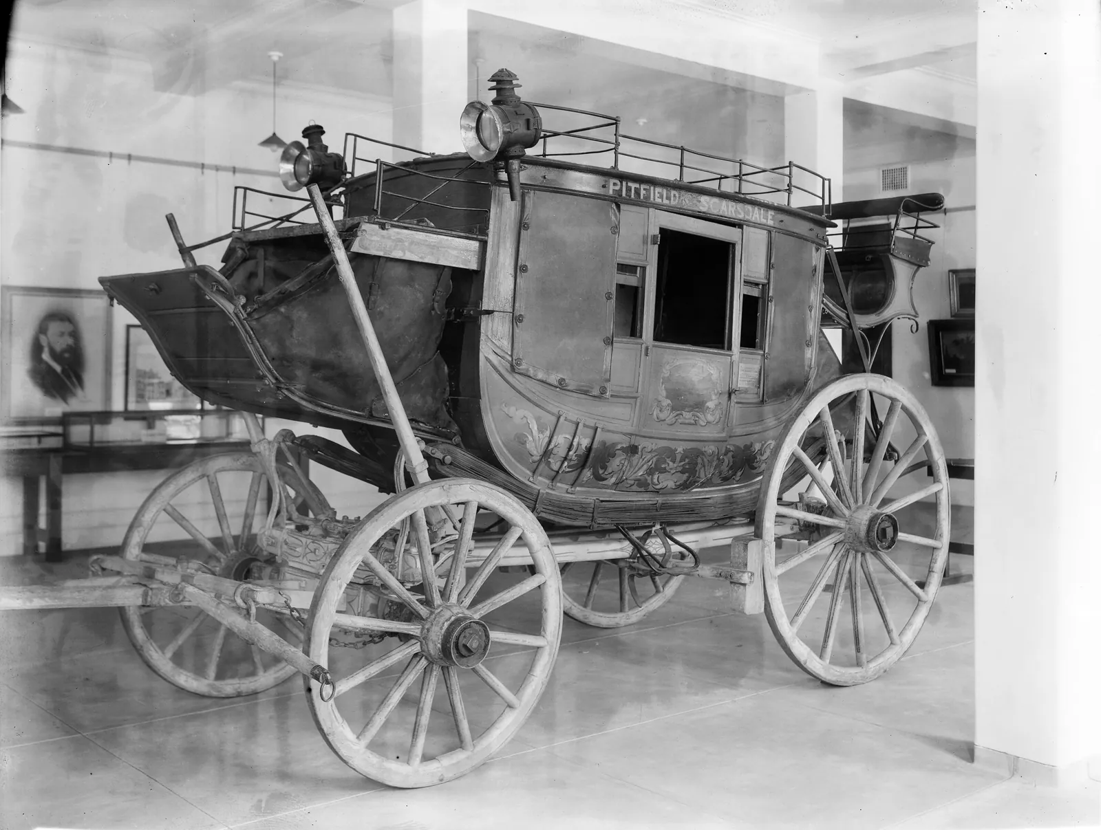
The Aisbetts’ Pitfield–Scarsdale coach in the Public Library, 21 June 1935. It ran against the railway at a shilling a fare, and is in Museums Victoria now. State Library Victoria, H24724 From vicsig.net, Scarsdale, Victorian Places, Scarsdale, Museums Victoria, the Aisbetts’ coach, the Victorian Heritage Database, Scarsdale-Newtown precinct and Rail Trails Australia.
1906
The Old Boys come home
The first Scarsdale Old Boys’ Reunion was held on 6 September 1906, and they kept coming back every year into the middle of the century. In October 1908 they were received in the Town Hall, seventy dined at the Royal Exchange, and a hundred and fifty old boys and girls were welcomed at the school. A suggestion that the old girls take part in future would, the president said, “receive consideration”.
Their secretary, J. G. Roberts, born at Italian Gully in 1860, photographed the reunions of 1908, 1909, 1910 and 1912 into an album now in the State Library. For the borough’s jubilee in 1912 the Old Boys published The Story of Browns and Scarsdale, and Roberts laid the jubilee stone of the Town Hall extension on 17 October.
Fig. 6
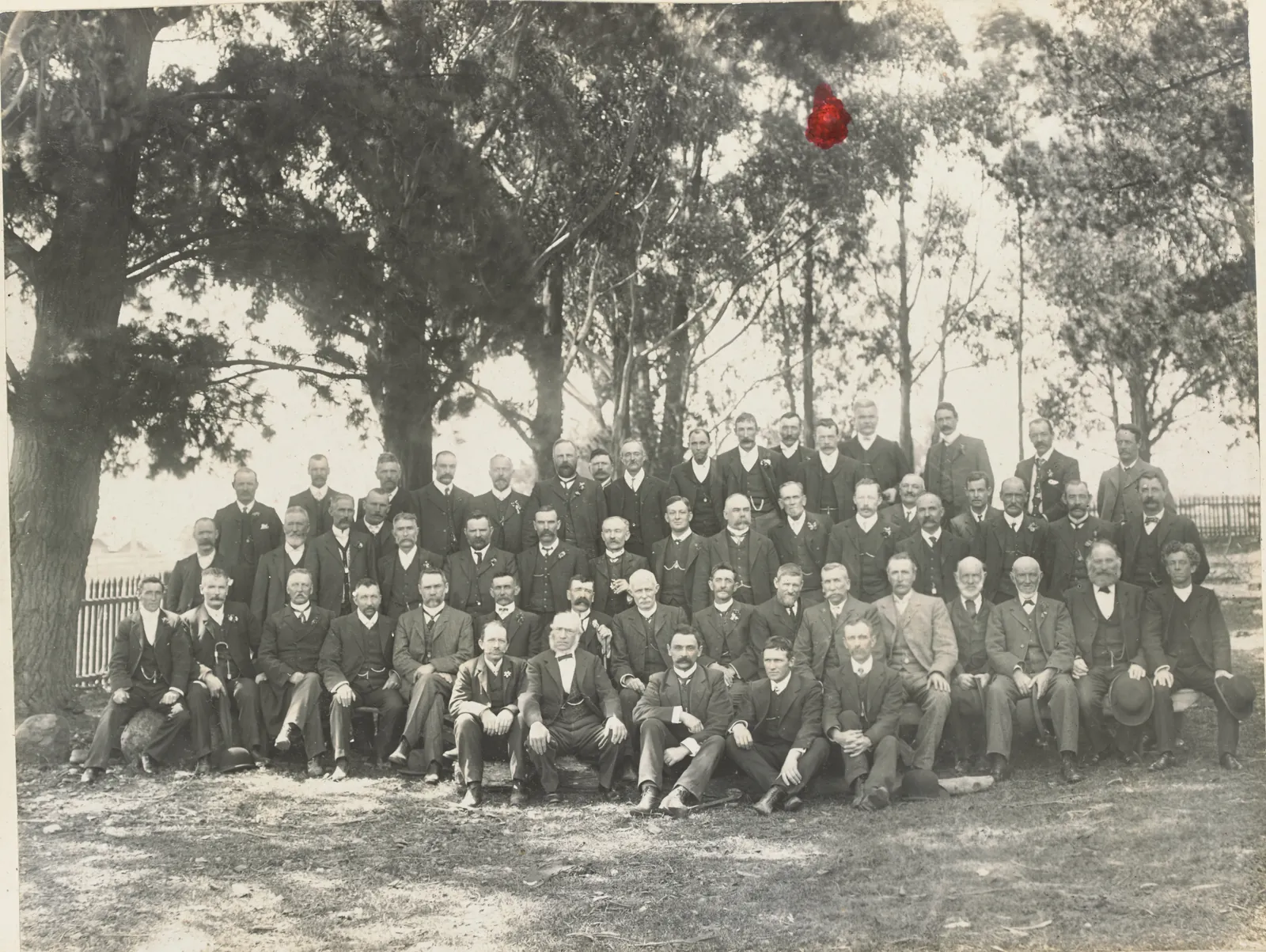
The Old Boys’ visit to Scarsdale, Saturday 24 October 1908. Animated by AI from the photograph; the movement is ours, not the archive’s. J. G. Roberts’s album, State Library Victoria, MS 15304 From the Victorian Heritage Database, Scarsdale Primary School No. 980, the Ballarat Star, 27 October 1908, J. G. Roberts’s album, State Library Victoria MS 15304 and the Bendigo Advertiser, 28 November 1912.
1912
The jubilee, and the long decline
By 1903 the town lived more by farming than by mining. Between 1910 and 1920 the borough’s population more than halved, and on 1 October 1915 it was joined to the Shire of Grenville. Browns and Scarsdale had 2,121 people in 1871; Scarsdale had 219 in 1921.
On the plan: 2, The old town hall.
Fig. 7
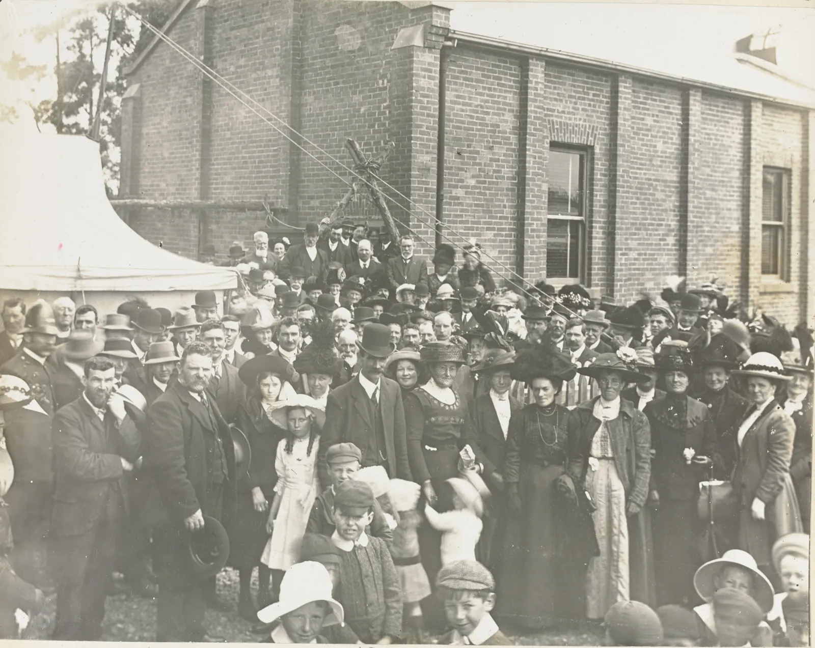
Laying the jubilee stone of the Town Hall extension, 17 October 1912. Animated by AI from the photograph; the movement is ours, not the archive’s. J. G. Roberts’s album, State Library Victoria, MS 15304 From Victorian Places, Scarsdale, Victorian Places, Browns and Scarsdale and J. G. Roberts’s album, State Library Victoria MS 15304.
1918
The avenues and the gates
On 21 September 1918 avenues of honour were opened at Scarsdale and Newtown. The English elms, deodars and Atlas cedars on the Pitfield road are thinned now, best by the school. The white poplars on the highway are dated two ways: to this planting, or to after the Second World War.
In October 1922 the Old Boys and Girls unveiled memorial gates at the front of the school for the past pupils who did not come back.
On the plan: 6, School No. 980 and the memorial gates.
Fig. 8
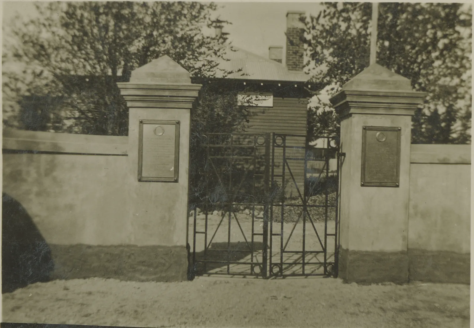
The Old Boys and Girls’ memorial gates at the school, in the 1920s. State Library Victoria, H82.288/4 From the Victorian War Heritage Inventory, the avenues of honour, the Victorian Heritage Database, Scarsdale Primary School No. 980 and the Victorian Heritage Database, Scarsdale-Newtown precinct.
2021
Scarsdale now
The churches closed one by one, the Methodist in 1953 and the Anglican in 1971, and many of the shops were pulled down. The school became a campus of Woady Yaloak Primary in 1994. The hotel, the hall, the old post office and the general store still stand at the crossroads.
At the 2021 Census 855 people lived in Scarsdale, counted over a wider area than the old township. In February 2024 a grassfire started at Newtown and ran into the Ross Creek State Forest.
On the plan: 1, The Scarsdale Hotel and the old post office.
From Victorian Places, Scarsdale, the Victorian Heritage Database, Scarsdale-Newtown precinct, Woady Yaloak Primary School, ABS 2021 Census QuickStats, Scarsdale and The Courier, 13 February 2024.
Where it happened
The town as it lies now, from OpenStreetMap, with the buildings in grey. The old shafts and mullock heaps are in ochre; the dashed line is the railway, now the rail trail. The numbers are the places this history names that can still be found.
1. The Scarsdale Hotel and the old post office. At the crossroads, where the public buildings always stood.
2. The old town hall. The Borough of Browns and Scarsdale’s, with a Bills horse trough beside it.
3. The railway station. Nothing survives; a rail trail board stands near the site.
4. The former Presbyterian church. Paget Street. Privately owned.
5. The Methodist manse. 12 Carlyle Street, the last trace of the Methodists here.
6. School No. 980 and the memorial gates. On the Pitfield road, with the 1918 avenue in front.
7. Main Lead Co. Smythes and Brownes Junction, 1860.
8. Bute Co. On paying gold in April 1861.
9. Grand Reliance Co. Warrens Lead, 1859.
10. Browns: the North Briton Lead. Found in November 1858.
11. Browns: the Golden Gate and the Contest Lead. The Golden Age Co.’s rich find of 1879.
12. The cemetery. In use since 1859, with a Chinese section.
Scarsdale now
Checked 1 October 2026. Something missing, closed or wrong? Write to hello@onelobster.au
Scarsdale Hotel
Pub · 15 Pitfield–Scarsdale Road, just off the highway
The town’s pub since the nineteenth century: a bar, a bistro and a beer garden. Ring for when it’s open.
Scarsdale General Store
Store and post office · 2069 Glenelg Highway
The store, with Scarsdale’s post office inside it.
Woady Yaloak Primary School
School · Scarsdale campus, 149 Pitfield–Scarsdale Road
One of four campuses, with Smythesdale, Snake Valley and Ross Creek. School No. 980 has stood on this ground since 1871.
(03) 5342 8565woady.yaloak.ps@
education.vic.gov.auwoadyyaloak.vic.edu.au Woady Yaloak Kindergarten
Kindergarten · 25 Pitfield–Scarsdale Road, next to the hall
Three- and four-year-old kinder, run by the Eureka Community Kindergarten Association.
Scarsdale fire station
CFA · 12 Scarsdale–Pitfield Road
The Smythesdale Fire Brigade’s Scarsdale station. In an emergency ring 000.
Scarsdale Town Hall
Hall · 23 Scarsdale–Pitfield Road
The old borough’s town hall, looked after by Scarsdale Town Hall Inc., with a Bills horse trough out the front. To hire it, ring the number the shire lists for bookings.
Scarsdale Community Men’s Shed
Men’s Shed · Brewer Street
New members welcome. Lawns mowed, handyman jobs and small engines serviced; old batteries and scrap metal collected for the shed’s funds. Meets on the second and fourth Monday.
CWA Scarsdale Branch
Club · Meets in Smythesdale, at 55 Heales Street
Scarsdale’s Country Women’s Association branch. It meets every month in Smythesdale.
Kanga Dig It
Landscaping · Based in Scarsdale
Garry Smith: landscaping, turf, irrigation, earthworks, garden maintenance and firewood, across Ballarat.
The park behind the hall
Park · Behind the town hall, Scarsdale–Pitfield Road
A playground, a barbecue, shelters, picnic tables and toilets.
Ballarat–Skipton Rail Trail
Walk and ride · The old station site, off the highway
The old Skipton line, 54 km of path. A board marks the station, with a bike repair stand beside it. Nimons Bridge, the trestle over the Woady Yaloak, is about 4.5 km on towards Linton.
Smythesdale Cemetery
Cemetery · Glenelg Highway, between Scarsdale and Smythesdale
In use since 1859, and once inside the Borough of Browns and Scarsdale. Kept by a volunteer trust; open every day except on Catastrophic fire danger days.
Scarsdale Bushland Reserve
Reserve · East of the town, towards Browns
Parks Victoria bush on the old Browns diggings side of town.
Woady Yaloak Creek Rest Area
Rest area · Glenelg Highway, west of town by the river
A roadside stop where the highway crosses the Woady Yaloak.
To read more
The Old Boys’ own history, The Story of Browns and Scarsdale (1912), and the two that followed it, Scarsdale Reminiscences 1906–1981 (1981) and Joan Hunt’s Come Back to Scarsdale (2006), are not online. The State Library holds them, and the Woady Yaloak Historical Society, which looks after the old court house at Smythesdale, keeps the district’s records in its research room at The Well, 19 Heales Street, open on Wednesdays.
Sources
Everything above was read on 1 October 2026. Where two sources disagree, the page says so.
- Wadawurrung Traditional Owners Aboriginal Corporation
- Joan Hunt, “The Scots at Springdallah”, Provenance 13 (2014)
- Victorian Places, Browns and Scarsdale
- J. G. Saxton, Victoria Place-Names and Their Origin (1907)
- Victorian Places, Scarsdale
- The Victorian Heritage Database, Scarsdale-Newtown precinct
- The Heritage Inventory, North Briton Lead
- The Heritage Inventory, Main Lead Co.
- The Heritage Inventory, Bute Co.
- The Woady Yaloak Historical Society’s sign at Smythesdale, as Aussie Towns transcribes it
- The Victorian Heritage Database, Smythesdale Cemetery
- The Victorian Heritage Database, Scarsdale Primary School No. 980
- Useful Knowledge 37 (Mechanics’ Institutes of Victoria, 2015)
- Sovereign Hill’s education blog
- Vicsig.net, Scarsdale
- Museums Victoria, the Aisbetts’ coach
- Rail Trails Australia
- The Ballarat Star, 27 October 1908
- J. G. Roberts’s album, State Library Victoria, MS 15304
- The Bendigo Advertiser, 28 November 1912
- The Victorian War Heritage Inventory, the avenues of honour
- Woady Yaloak Primary School
- ABS 2021 Census QuickStats, Scarsdale
- The Courier, 13 February 2024
- State Library Victoria, H89.105/208
- State Library Victoria, H2037
- State Library Victoria, H35212
- State Library Victoria, H24724
- State Library Victoria, H82.288/4